Yesterday my Fedora 23 did not show up the 3G-Modem (USB) in Network Manager Mobile Connections (using KDE; Kerndel 4.3). Having a look with dmesg reported a registered modem…
![]()
Yesterday my Fedora 23 did not show up the 3G-Modem (USB) in Network Manager Mobile Connections (using KDE; Kerndel 4.3). Having a look with dmesg reported a registered modem…
![]()
Today I started to test the developer-version of the upcoming QGIS 2.14 and found a nice feature integrated out-of-the-box. In previous QGIS-versions tracing along existing geometries required 3rd-party plug-ins (e.g. http://isticktoit.net/?p=131) – now it looks like integrated with QGIS 🙂
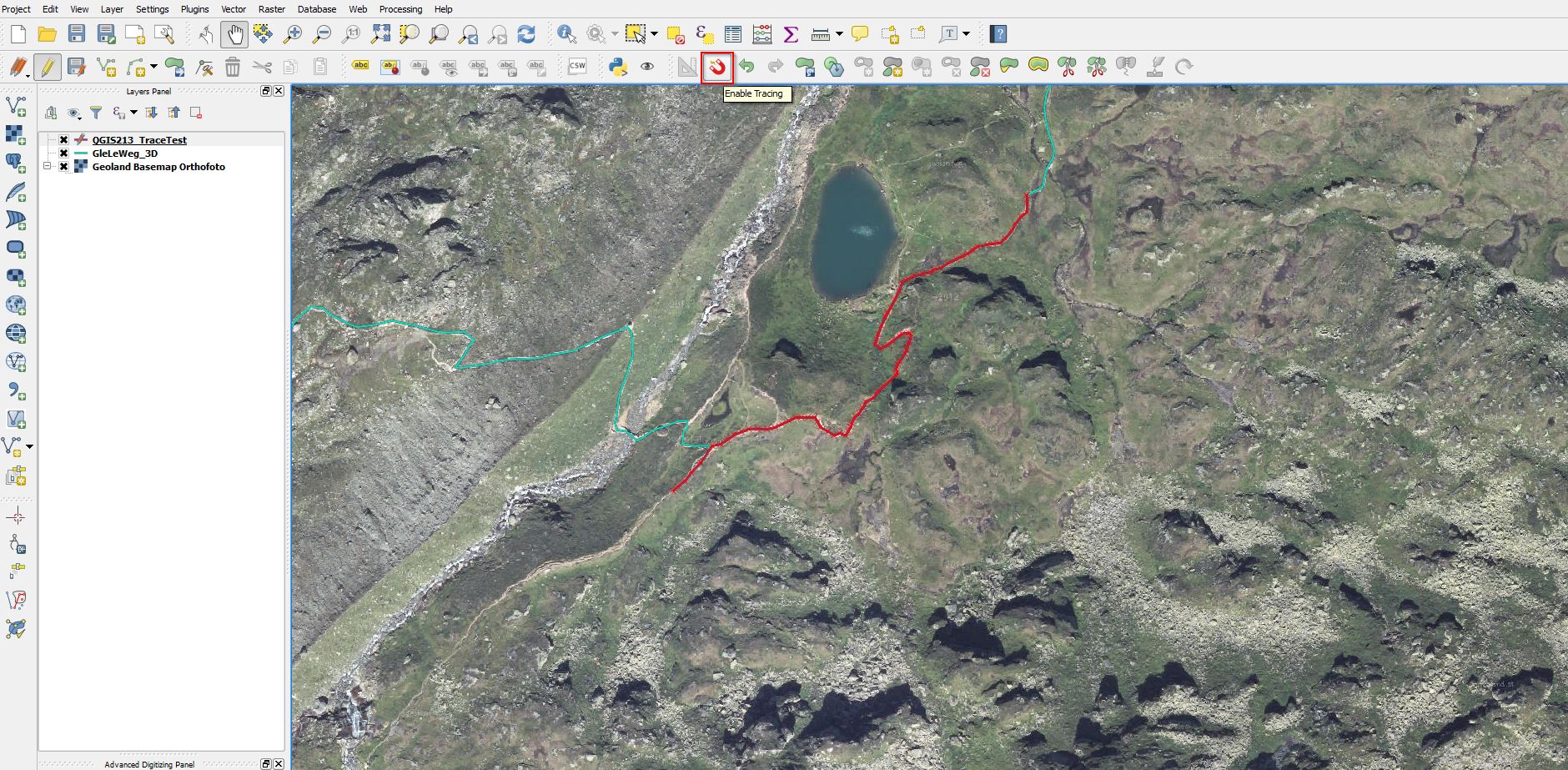
Update 7.3.2016: Lutra Consulting describes all details in it’s Blog
Many different organisations have to deal with the management of guideposts – especially in alpine regions. Sometimes all the data about the guideposts is managed in databases and GIS-Systems, often no digital data management is in use. In the first case mostly internally developed databases/applications are used and there is no open technical “standard” for storing “guidepost-data” and EXCHANGING it. In some regions – like in Tyrol – governmental standards for the guideposts (“the hardware”) are available (how guideposts have to look like – e.g. size, classification of difficulty, …). Based on the idea that around the world guideposts have some elements (direction, name of target,…) in common, we started to work on a modern technical standard…

Finding the right track – defining guideposts with JSON weiterlesen