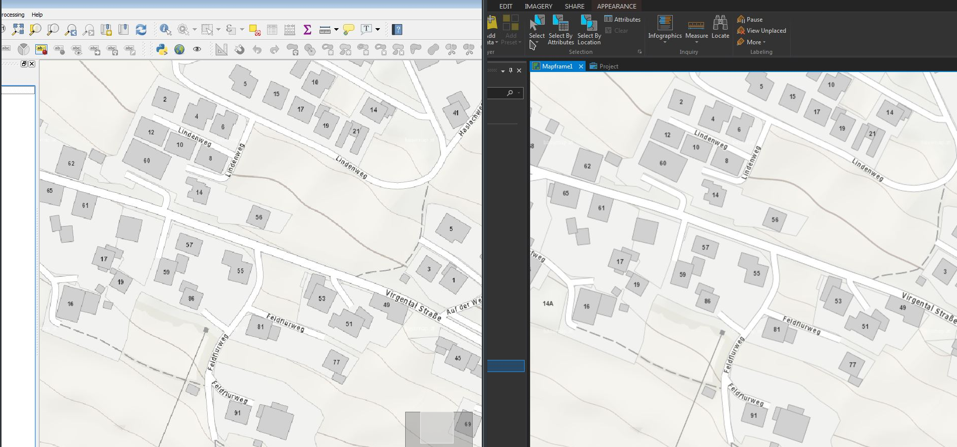
The upcoming QGIS 3.0 (www.qgis.org) is heavily under development and it was time to have a quick first glimpse on the recent developer-version (2.99-Master). QGIS 3.0 will be based on Qt5 and Python 3 – using the actual 2.99-Master was like “being at home” with some nice new furniture…
Some days ago I thought about using a Linux-Distribution from an USB-Stick, not a Live-System – instead installing a Distro on a Stick. USB 3.0 performs quite decent and USB-Sticks >= 32GB are quite cheap. But does installing a Linux-Distro from the Install-Live-Stick to an empty Stick really work (and boot) ?
It’s has been a long time since I had time for some useful and useless stuff. So we (isticktoit) found some useless stuff on Heise open: A Linux Retro-Gaming distribution and thought about bringing some old stuff up to ‘waste’ some hours.
4:3 on a FullHD TV and pixels
In this case I tried the new release of the Lakka distribution, which is mostly for Retro/Emulator-Gaming. It contains a lot of emulators from Atari up to PlayStation and Nintendo.
Using the WMTS-Service basemap.at in ESRI ArcGIS Pro (v 1.4) and QGIS (v 2.18) I discovered some differences in the display-quality of the WMTS-Service in both programs – while basemap.at was a beauty in ArcGIS Pro, the display-quality in QGIS was not that smooth… (@same extent etc.)
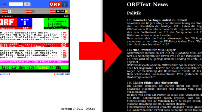
Believe it or not, tens millions of people are still reading Teletext. The biggest provider of on-screen news, the BBC, has shut down its CeeFax in 2012, but many stations all over Europe still broadcast a teletext signal1. There even is a (semi-) regular Art Festival about teletext!
For those not in the know: Teletext, invented by the BBC in 1972/1974, is a digital signal, that puts a 40×25, 8 color character grid onto your screen. Rudimentary (pseudo-)graphics in the form of a graphical character set are available too. The information is sorted into pages (often called tables), from 100 to 899, and subpages2. Parsing DVB-T/S/C Teletext into plain text weiterlesen →
Is the widely pushed OGC Geopackage (GPKG)(http://www.geopackage.org/) ready for daily use – also as a replacement for the good old Shapefile as an exchange-format ? While QGIS already supports Geopackage (including direct editing) quite well for some time, the format starts to grow up in the ESRI environment. Some good news with ArcGIS Pro 1.4 …
Sport watches like the Garmin Swim or Forerunner-series are widely used. As a Linux-User, I was facing the “problem” how to get the data on the PC from my Garmin swim (and to GarminConnect) … there are a lot of solutions around on the internet (some very old ones) – the following workflow works fine for me to get the data on the PC and upload it to GarminConnect.
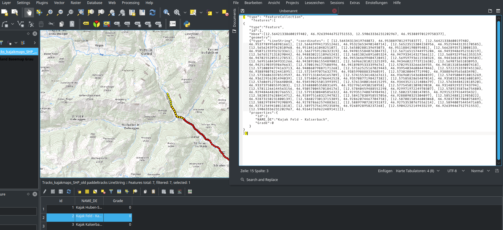
Fooling around with QGIS (v 2.18) global program-settings, I found some interesting setting. It allows the user to copy geo-features directly from the table to the clipboard as GeoJSON (geom + attributes). So, no “export to…” etc. is needed.
===============================================
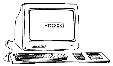
Back to the Future: Using a DEC VT220 from 1983
===============================================
I bought an actual serial terminal. It is many years older than I am, and can display 24 lines by 80 (or 132) colums of text.
My workflow is quite terminal centric: Work for Uni is done with vim over ssh, emails are read with mutt, and ncmpcpp provides the front end to my music. If it weren’t for the Internet, I’d ditch the display server without batting an eye. Back to the Future: Using a DEC VT220 from 1983 weiterlesen →
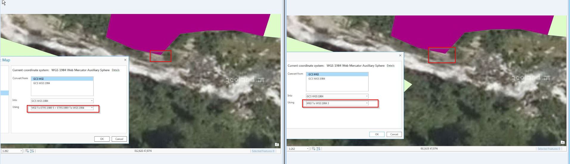
Nachdem ArcGIS Pro von ESRI erwachsen wird und sukzessive vermehrt im GIS-Alltag zum Einsatz kommt, anbei ergänzend zur Serie zur Anwendung bestmöglicher Transformationsparameter zwischen dem österreichischen Bundesmeldenetz und WGS84/ETRS89 die Implementierung dieser in ArcGIS Pro (Stand Version 1.3.1).
Transformation EPSG1618 (Position Vector) versus NTv2 AT_GIS_GRID – ein kleiner Unterschied