Since ArcGIS Pro 2.2 and QGIS 3.2 arrived recently, it was time to have again a look if and how the AT_GIS_GRID for CRS-transformation between Austrian BMN (Bundesmeldenetz) and ETRS89 (and WGS84) is implemented. The easy question: Does EPSG::5891 (AT_GIS_GRID NTv2 transformation) work out of the box ?
Wer sich wundert warum im Umfeld von Behörden & Verwaltungen soviel proprietäre Software in Verwendung ist, für all diese gibt es seit Montag (19.02.2018) eine sehr gut recherchierte Dokumentation des ARD & c’t dazu.
Abseits der Argumente des “Vendor-Locks”, Sicherheitsbedenken (Einsatz von US closed source Software im Militär- und Polizeibereich) etc., sollte man nicht die Möglichkeit des Aufbaus einer europäischen Softwareindustrie vernachlässigen und damit von zukunftssicheren Arbeitsplätzen – anstatt das Steuergeld quasi übern großen Teich zu überweisen, eben in den Aufbau einer europ. Softwareindustrie investieren – auf Basis offener Software und offener Standards. Liebe Politik und öffentliche Verwaltung: Statt auf Lobbying reinzufallen, besser Zukunftschancen sehen ! 🙂
I didn’t use Netflix for some month on my Nexus 7 tablet with Cyanogenmod 13 (Android 6). A few days ago I wanted to use the netflix app – and what a surprise: films only play with audio, no video. Maybe an update of the app ? Nothing was available and the best… it was not listed anymore in my PlayStore :-/
DNS is one of the old timers that keep the internet working. Back when it has been designed privacy wasn’t that much of an issue. Nowadays DNS can leak critical information about the activity of a user. Even tools that should protect the privacy of the user (e.g. VPNs, TOR, … ) can leak DNS queries if not configured correctly. Currently the IEFT works on draft for DNS over Datagram TLS, but if you want to take back your privacy right now, DNSCrypt is at your service.
An entirely new Firefox – why reinvent the wheel again?
Why ? Performance, new clean codebase, better support for new technologies, other philosophy, …
Not the City in Austria – the programming language
The upcoming QGIS 3.0 (www.qgis.org) is heavily under development and it was time to have a quick first glimpse on the recent developer-version (2.99-Master). QGIS 3.0 will be based on Qt5 and Python 3 – using the actual 2.99-Master was like “being at home” with some nice new furniture…
Some days ago I thought about using a Linux-Distribution from an USB-Stick, not a Live-System – instead installing a Distro on a Stick. USB 3.0 performs quite decent and USB-Sticks >= 32GB are quite cheap. But does installing a Linux-Distro from the Install-Live-Stick to an empty Stick really work (and boot) ?
It’s has been a long time since I had time for some useful and useless stuff. So we (isticktoit) found some useless stuff on Heise open: A Linux Retro-Gaming distribution and thought about bringing some old stuff up to ‘waste’ some hours.
4:3 on a FullHD TV and pixels
In this case I tried the new release of the Lakka distribution, which is mostly for Retro/Emulator-Gaming. It contains a lot of emulators from Atari up to PlayStation and Nintendo.
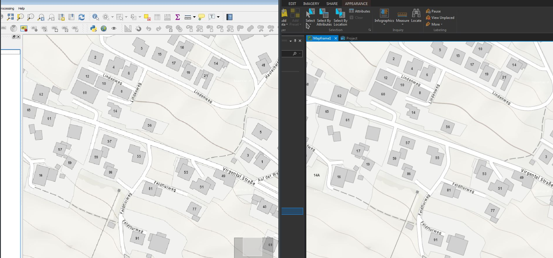
Using the WMTS-Service basemap.at in ESRI ArcGIS Pro (v 1.4) and QGIS (v 2.18) I discovered some differences in the display-quality of the WMTS-Service in both programs – while basemap.at was a beauty in ArcGIS Pro, the display-quality in QGIS was not that smooth… (@same extent etc.)
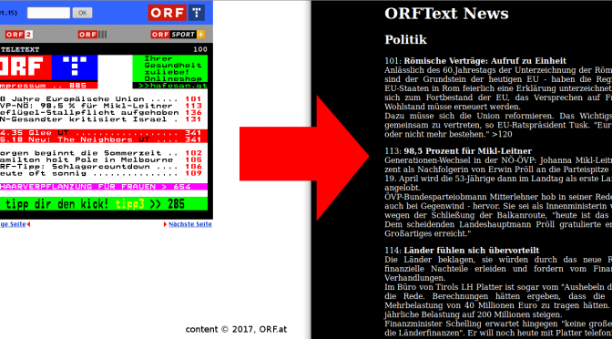
Believe it or not, tens millions of people are still reading Teletext. The biggest provider of on-screen news, the BBC, has shut down its CeeFax in 2012, but many stations all over Europe still broadcast a teletext signal1. There even is a (semi-) regular Art Festival about teletext!
For those not in the know: Teletext, invented by the BBC in 1972/1974, is a digital signal, that puts a 40×25, 8 color character grid onto your screen. Rudimentary (pseudo-)graphics in the form of a graphical character set are available too. The information is sorted into pages (often called tables), from 100 to 899, and subpages2. Parsing DVB-T/S/C Teletext into plain text weiterlesen →