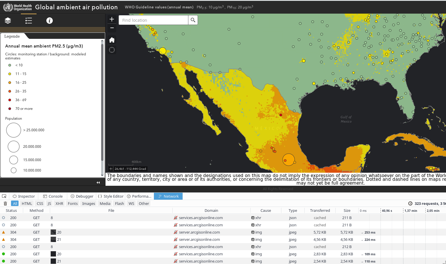
The last days media was crowded by the WHO air pollution map. As someone a little bit map-addicted I had a quick deeper look at it and was surprised: It looks like air-(pollution) in some cases stops exactly at political borders…
As a QGIS-User on Fedora-Linux I was at first happy having QGIS 2.14.x (LTR) in the Fedora 24 repository. After installing it with DNF the problems started… QGIS had some missing dependencies:
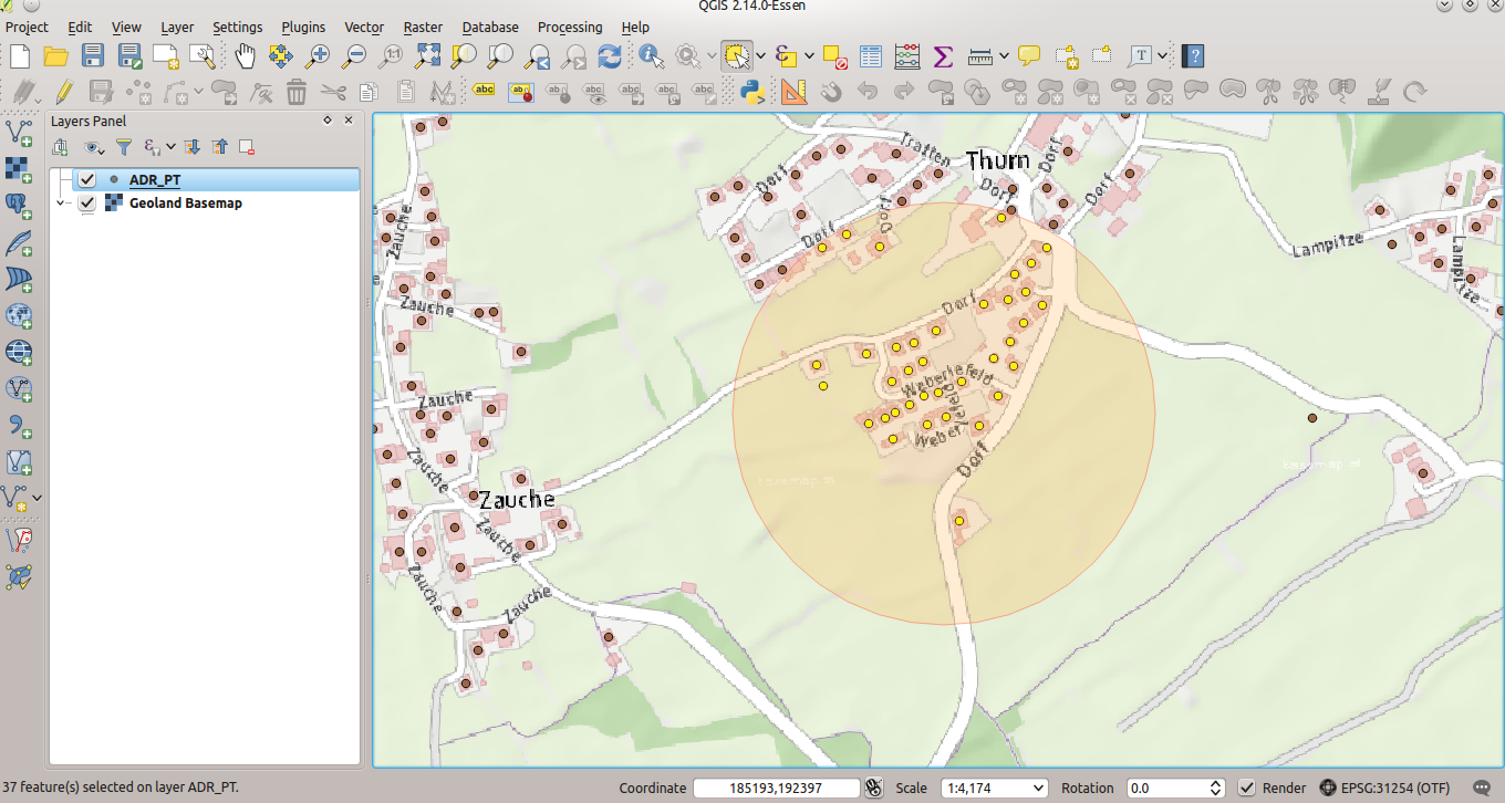
After importing geodata from the GIS to MongoDB and creating a spatial index (part 1), the exciting (spatial) adventure starts. With “normal” (relational) databases and their spatial extensions (Oracle spatial, PostgreSQL/PostGIS, SQLite/Spatialite,…) a lot of spatial queries and geoprocessing are possible. So let’s try to find out which adresses have to be evacuated 250m around some “event”…
How to perform a spatial query like this with MongoDB ?
MongoDB (3.2) is a kind of database-hipster at the moment – with improving support for spatial data. So it was time for me to discover some of it’s features concerning spatial data. As a GIS-user my first intention was to get some bigger simple (point) geodata into MongoDB. Part 1 covers this topic, part 2 will cover some spatial operations within MongoDB. I also want to do some performance checks between PostgreSQL/PostGIS and MongoDB related to geodata.
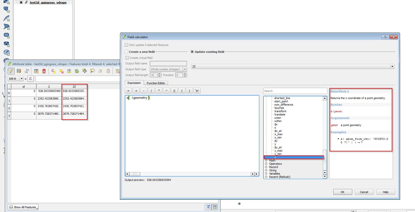
Today I tried QGIS 2.13 (dev-version of the upcoming 2.14) and had a look at the now implemented support for “3D-Features” (2.5d support). It works well and makes the workflow described some months ago easier.
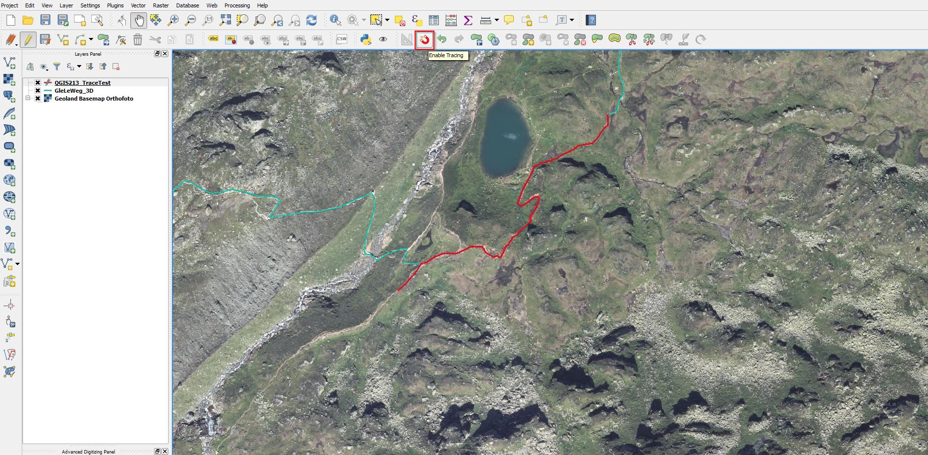
Today I started to test the developer-version of the upcoming QGIS 2.14 and found a nice feature integrated out-of-the-box. In previous QGIS-versions tracing along existing geometries required 3rd-party plug-ins (e.g. http://isticktoit.net/?p=131) – now it looks like integrated with QGIS 🙂
QGIS 2.14 Trace
Update 7.3.2016: Lutra Consulting describes all details in it’s Blog
Sometimes (eg. doing it for a bulk of geodatasets) converting and transforming geodatasets from their Source-CRS to another with command line tools like ogr2ogr (http://www.gdal.org/ ) can be helpful.
With ogr2ogr it’s also an easy task to use NTv2-based transformations like for Austria the AT_GIS_GRID.
One of the most precise and best ways to transform geodata from the Austrian MGI-System to ETRS89 is using the AT_GIS_GRID (NTv2 Transformation) provided by the BEV. Thanks to the developers of the NTV2-PlugIn for QGIS it is really easy to use now.