The app GoogleTracks for Android-Smartphones is an easy to use tool for logging GPS-Tracks with your phone – & it allows you to export the Tracks to GPS and KML. So it’s no problem to get your tracks in your GIS-Software.
How-To with QGIS 1.8
Export your Track to GPX in GoogleTracks on your phone
Copy the *.gpx on your computer (or by the way mail it from your phone 🙂 )
You can directly open the GPX in QGIS with “Add vector”
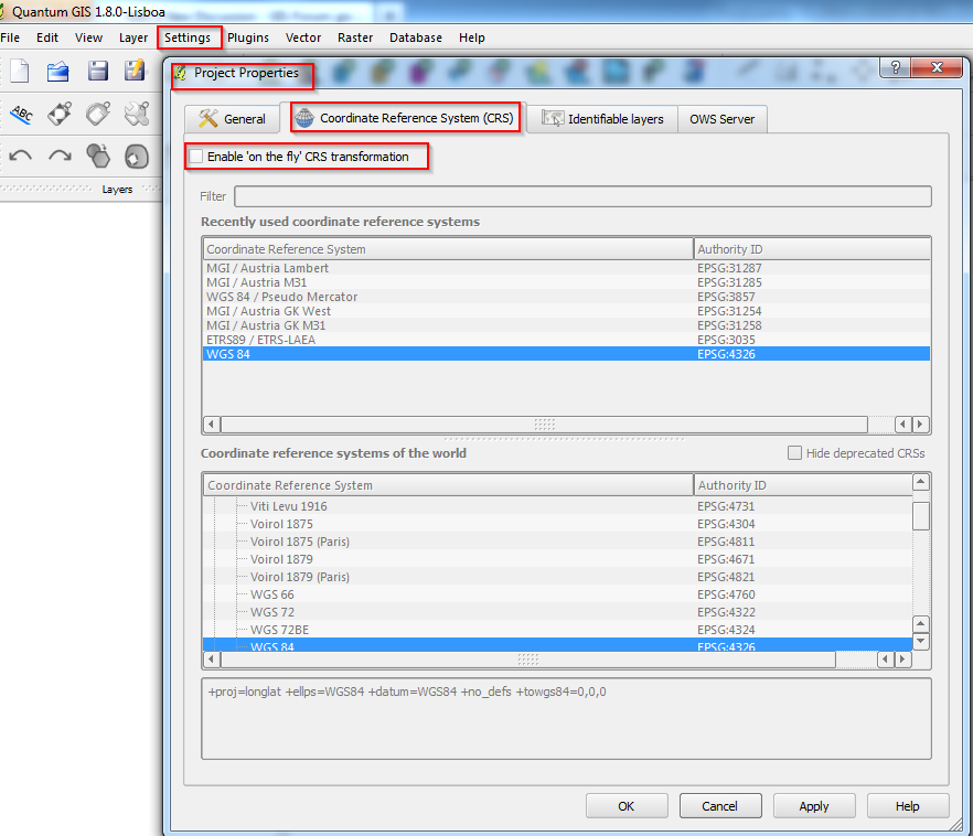
Attention: GPS-Data is saved in GCS WGS84 ! If you combine it with layers in your national CRS be aware of using the correct transformation-parameters !
In QGIS it is possible (and it’s recommended) to define the project’s CRS (coordinate system).
For Austria MGI M31 use EPSG Code 31258. See screenshots attached.