Livestreams often use Adobe’s Flash format and Shockwave Flash-Players to supply live content to their users. To play them on a machine that hasn’t flash installed, many pipe rtmpdump’s output to their favourite media player, making integration into home cinema systems complicated. If the URL of the stream you watch regularly does not change (e.g. a TV station’s official livefeed), you can easily play this in XBMC.
Archiv der Kategorie: Sticked!
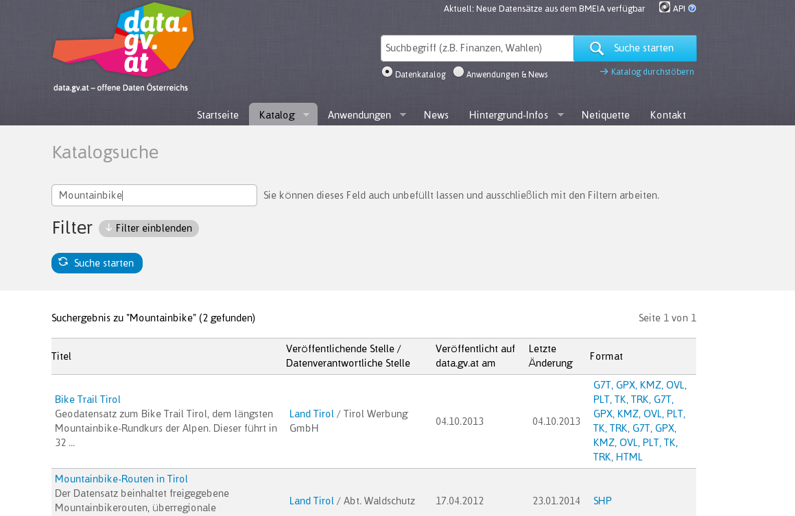
Open(Geo)data in Österreich – Freie GEODatenvielfalt
Lange Zeit hat man neidvoll vor allem bei US-amerikanischen Behörden freie Geodaten erblickt und beziehen können – von Landsat-Bildern bis hin zu “topographischen Labels” für fast die ganze Welt von der NIMA.
Zusehends springen in Europa öffentliche Einrichtungen auf den OpenData bzw. OpenGovernmentalData (OGD)-Zug auf (http://de.wikipedia.org/wiki/Open_Data) und stellen u.a. auch spannende und wertvolle Geodaten frei zur Verfügung, so auch in Österreich.
Open(Geo)data in Österreich – Freie GEODatenvielfalt weiterlesen
How to save a stream among Linux?
If you are watching a Flash stream (not youtube) then it is possible to save it to a FLV file.
At first you have to buffer the full stream that is the gray bar.
When it is full loaded, execute at first this to locate the flash buffer:
lsof | grep Flash
Install Android on Odroid-U3 (SD-Card, Linux)
Some words on how to install Android on your Odroid-U3 using Linux:
- Download the Image from http://dn.odroid.com/4412/Android/
- Extract the ZIP-File with your GUI-ZIP-Tool or in Command-Line
- Prepare the Micro-SD (USB-Card Reader with your SD)
- Clear your SD with dd first: dd if=/dev/zero of=/dev/sdX bs=4M
(Depending on the size of your SD, this action can take a lot of time…) - Now we flash the image on the SD-Card: sudo dd if=image.img of=/dev/sdX bs=4M
- To safely remove the SD: sync
- Clear your SD with dd first: dd if=/dev/zero of=/dev/sdX bs=4M
- Now we insert the SD into our Odroid-U3 and first boot will proceed – and it will take some minutes (with black screen) !!! (Anyways At the first booting, the self-installing will take about 1~2 minutes. While installation, the blue LED is blinking and fan is running. The blue-LED will turn off after installation. Turn on again and enjoy.)
http://forum.odroid.com/viewtopic.php?f=78&t=3302
Python ArcGIS 10 – list all FeatureClasses in SDE-FeatureDataset (to txt-File)
If you want to list and write to a txt-File all featureClasses (in a FetaureDataset) stored in SDE/Oracle, it is done with a few line Python.
import arcpy
from arcpy import env
import os

# Set the workspace for the ListFeatureClass function
#
env.workspace = "Database Connections/VECTOR.arcsde01.sde/FEATURE_DATASET"

# Use the ListFeatureClasses function to return a list of
#  all shapefiles.
#
fcList = arcpy.ListFeatureClasses()

print str(fcList)

# setting up output-file and write to file
file = open("sdelayers.txt", "w")
file.write(str(fcList))
file.close()
Odroid-U3 XuBuntu – no image wrong HDMI-Setting. Reset HDMI-settings
If you don’t get an image via HDMI on your TFT/TV, sometimes it’s because of a wrong setting… and if you can’t connect to your Odroid with SSH (to run odroid-config), you have got a problem ![]() but just a small one.
but just a small one.
Put the SD in a Card-Reader and connect it to a Linux-PC.
The first partition, a fat partition will have a file named boot-auto.scr copy it to boot.scr (replace the old boot.scr there)
![]()
Now your little gadget should boot with an image on your screen ![]()
More information on this topic: http://forum.odroid.com/viewtopic.php?f=82&t=3281
Use BaseMap-Austria (basemap.at) with QGIS 2.x and ArcGIS 10.2.x
The Austrian govermental geodata-departments offer a free Basemap for Austria – Basemap.at (http://basemap.at/) – similar to GoogleMaps or OSM, based on official governmental data.
You can access this map via QGIS too – add a WMS/WMTS-Layer and use the following URL
http://www.basemap.at/wmts/1.0.0/WMTSCapabilities.xml

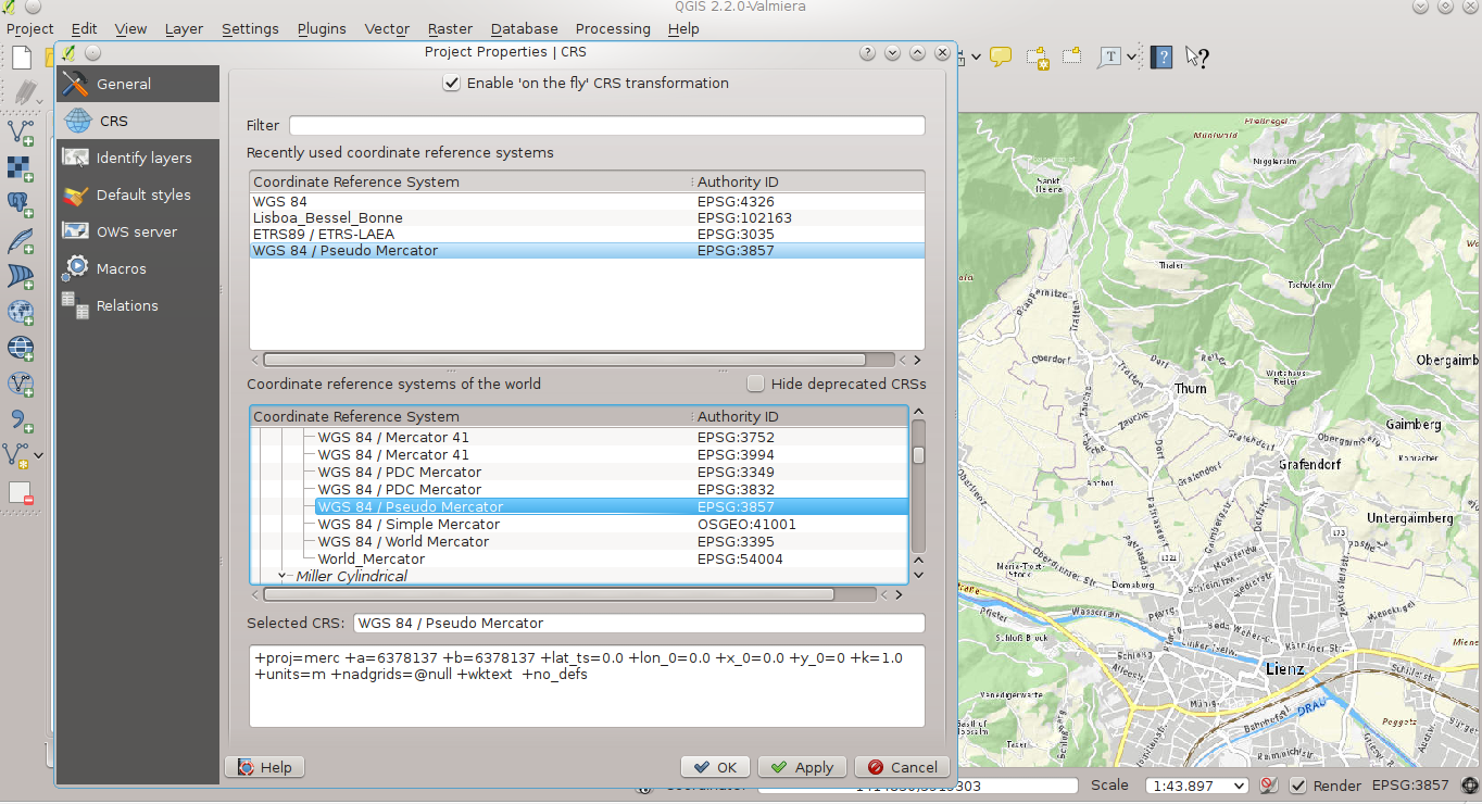
… for the best rendering-quality (no distortions) choose Google’s Pseudo Mercator as Project(Display)-CRS: EPSG 3857 (in QGIS 2.x: Settings – Project properties)
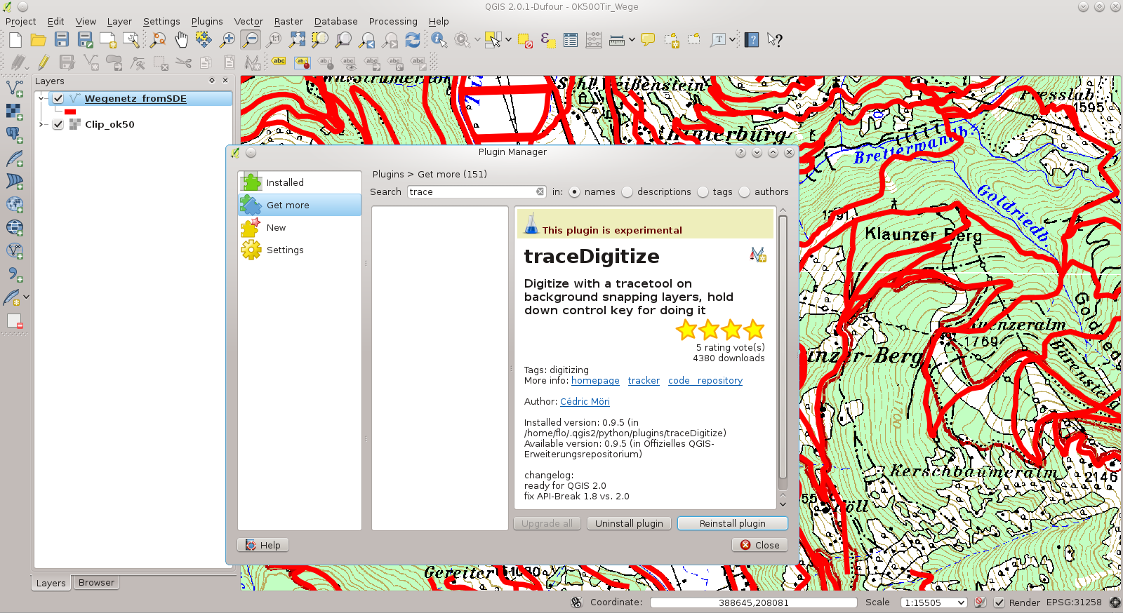
QGIS 2.x – Tracing-Function while digitizing (Trace Digitize)
If you want to follow existing vector-geometry (trace it), the plug-in traceDigitize is very helpful. Please be keep in mind to set the Snapping-Tolerance (Settings – Snapping Options).
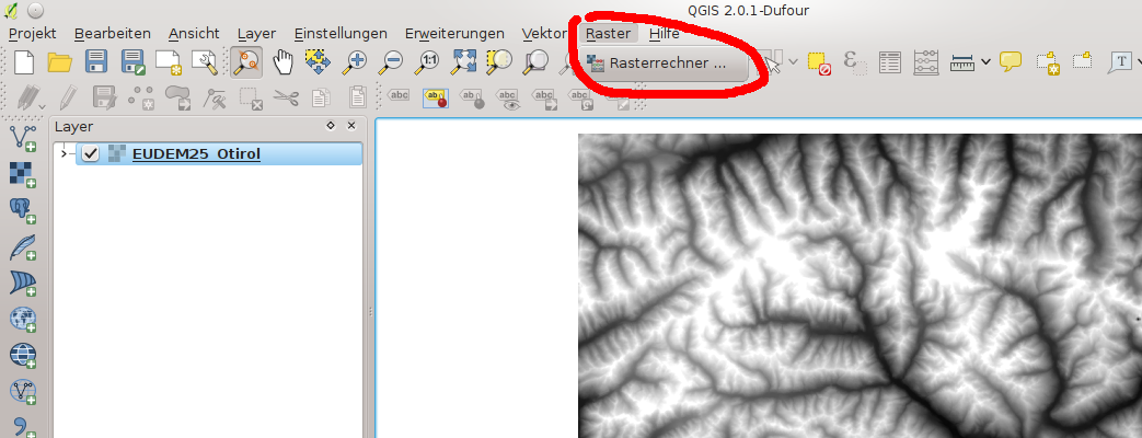
QGIS 2.0.1 on Fedora 20: Problems with “Raster-Menu”
After having QGIS 2.x successfully installed on Fedora 20 (yum install qgis) only the QGIS itself seems to be installed. You may get errors when trying to fetch new Plug-ins (Python!) or you have an nearly empty Raster-menu (without the GDAL-Tools).
In these cases install the following packages with YUM:
- qgis-python
- gtatool-gdal
- gdal
Screenshot-example (error): Missing GDAL-Lib – although the menu-items are in place:
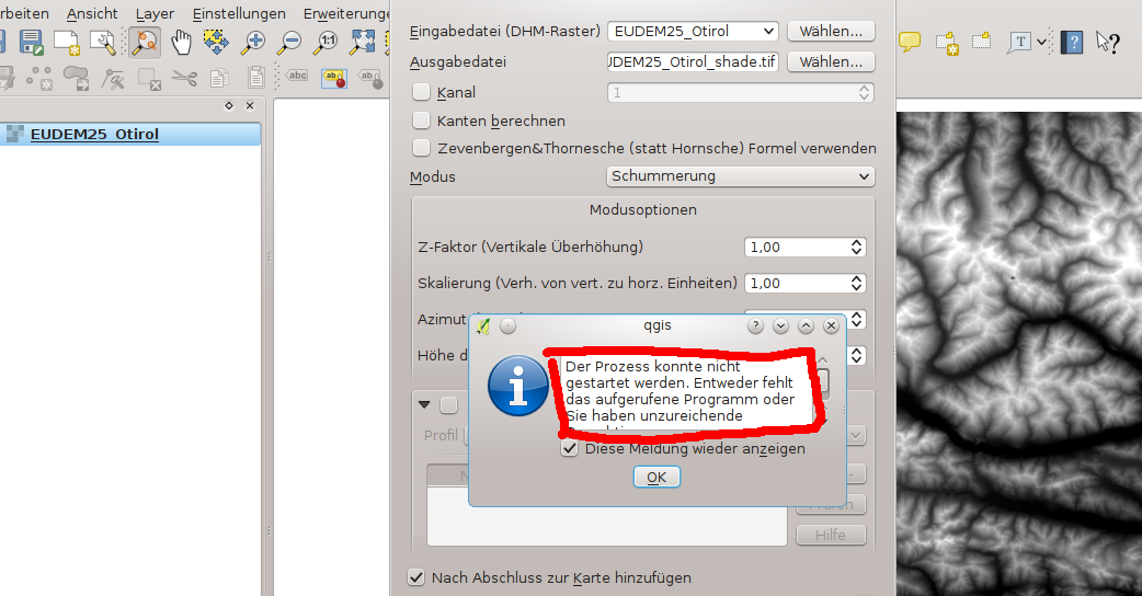
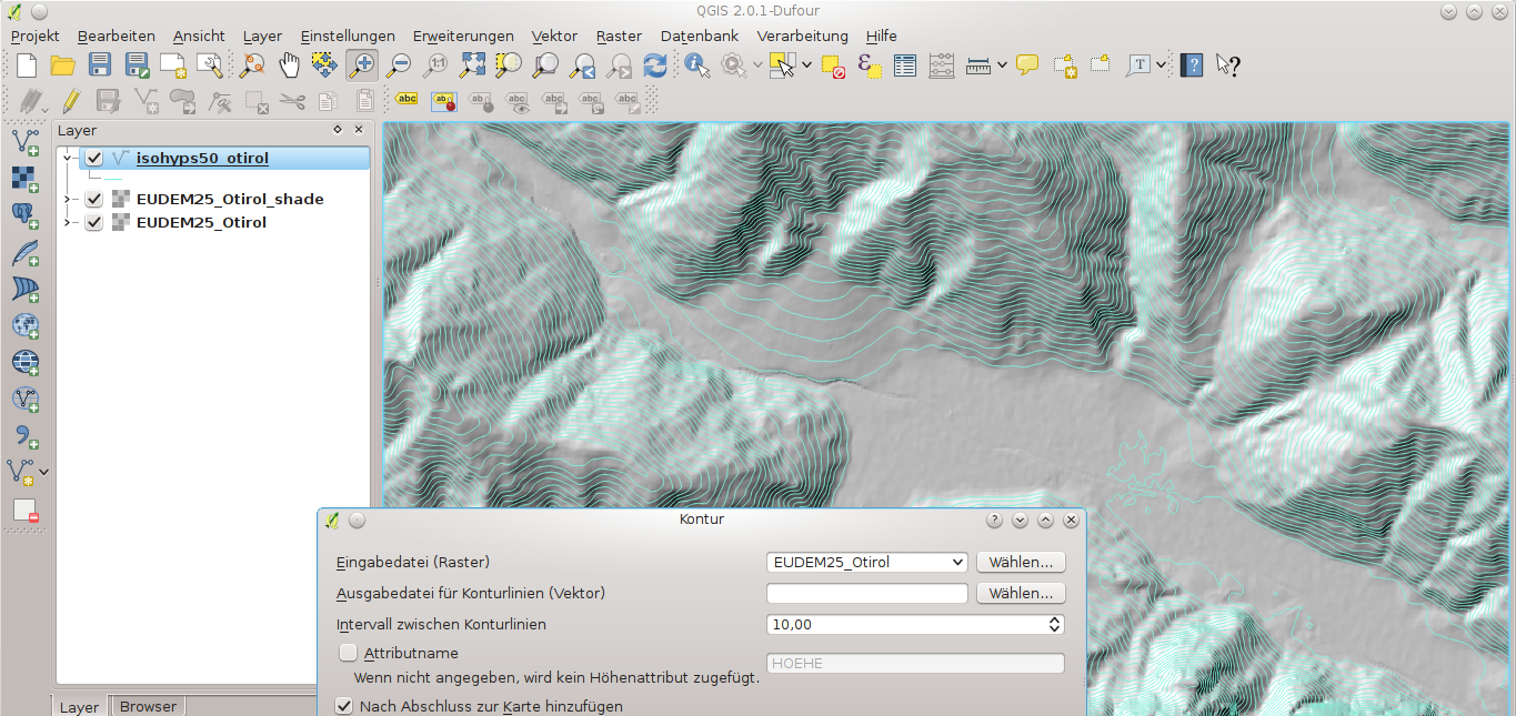
After installation of the above mentioned packages everything works fine 🙂 – e.g. hillshade and contour-lines
QGIS 2.0.1 on Fedora 19
Have a look at the Blog of Markus Neteler
http://courses.neteler.org/compiling-qgis-2-0-1-for-fedora-19-in-a-few-steps/
In case the page is offline (PDF): CompilingQGIS201forFedora19