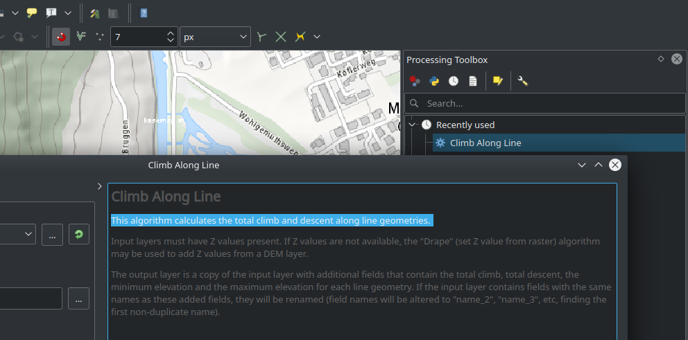
Not only people living in mountainous regions want to know the summarized positive and negative difference of altitude along a track (“line”). With QGIS 3.10 the new processing algorithm “climb along line” does the job for you.
What will be processed ?
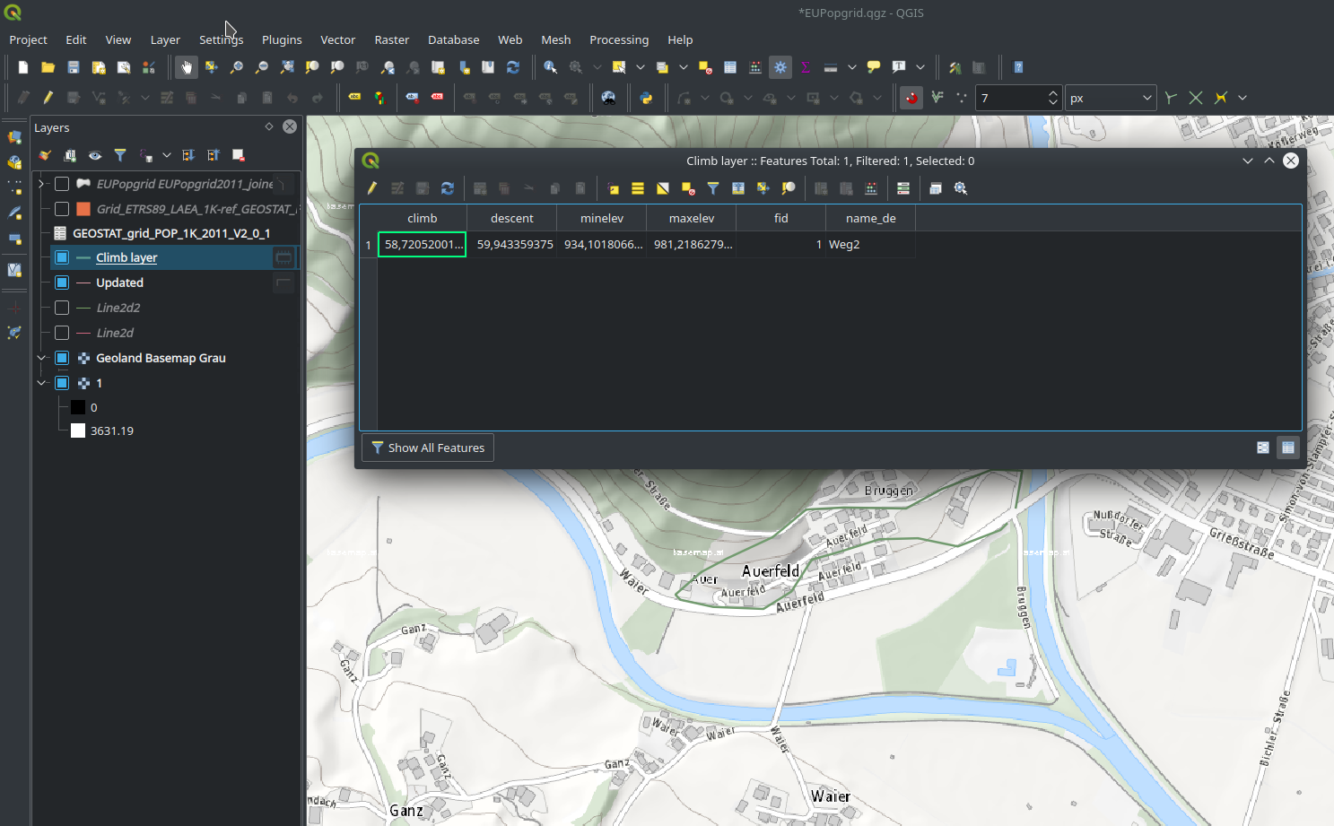
A copy of the input vector layer with additional attributes for each feature (the total climb, total descent, the minimum elevation and the maximum elevation).
The starting position…
A line geometry with z values (e.g. altitude) – e.g. generated with a DEM and the Drape-algorithm.
The result…
A new vector layer with the mentioned attributes in the table for each geometry 🙂
Sometimes the small new features are more than helpful 🙂